Summary
Maps have been produced for many purposes over the centuries, and in many forms, but once printing was established as a means of mass production, their publication became much easier than in earlier times, when they might have been drawn on parchment or vellum, woven into or painted on to cloth, or even built into a mosaic floor. Questions must arise over the accuracy of all the information to be found on historical maps, but they can serve as an indication of the lie of the land at the time of survey, and certainly reflect the view of the people involved in the creation of the map as to what was important enough to be included.
The thorough mapping of England and Wales began in the sixteenth century, when the dissolution of the monasteries resulted in major changes in land and property ownership. Christopher Saxton produced the earliest map of Norfolk in 1574 at a scale of approximately 3 miles to the inch, which does not offer the opportunity to show a great amount of detail. Saxton's was probably the first printed county map to be published, and was eventually incorporated into his Atlas of the Counties of England and Wales, which published in 1579.
Norfolk
Faden 1797
The first map of Norfolk at the scale of 1 inch to the mile was published by William Faden, a cartographer, engraver and publisher of maps, who became geographer to King George III and to the Prince of Wales. Surveying for this map was carried out between 1790 and 1794. The map was issued in six sheets and shows a wealth of natural and man-made features.
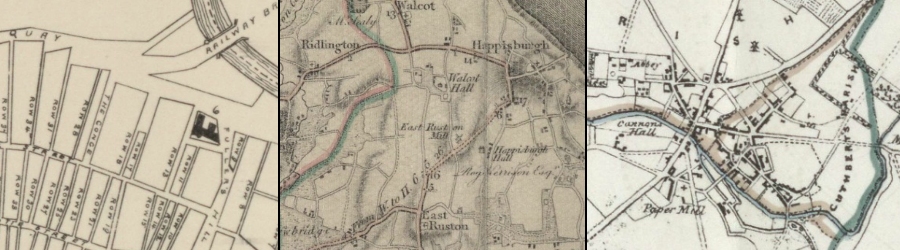
Bryant 1826
Andrew Bryant published a dozen county maps from 1822, before going out of business in 1835 due to the increasing difficulty in competing with the government-supported Ordnance Survey. Bryant's team surveyed Norfolk between 1824 and 1826, and the map was published in six sheets on 1 December 1826. At 10 miles to 12 inches, this map is at a slightly larger scale than Faden's, and so is able to show even more detail.
Norwich
Plan of the City of Norwich. Surveyed by W.S. Millard and J. Manning, 1830
An extremely detailed plan, showing the city within the walls. Individual buildings can be seen, and the beginning of the spread of development beyond the walls is clearly visible, although at this date it was still fairly limited.
Plan of the City of Norwich, Published by Jarrold and Sons, 1848
Earliest map of the city published by the well-known local company.
Illustrated Plan of the City of Norwich Published by C. Muskett, 1849
A plan of the city including a key to churches and public buildings.
Map of the City of Norwich compiled by A.W. Morant, City Surveyor, 1873
Plan of the city in mid-Victorian times which clearly illustrates its spread outside the city walls, with several streets laid out, but few houses yet built on them, and at least three ''intended new streets'' in the ''golden triangle''.
Great Yarmouth
Ordnance Survey Map of Great Yarmouth, 1832
Map accompanying the Boundary Commission report, showing old and proposed borough boundaries.
Jarrolds Map of Great Yarmouth, 1882
Town plan showing the Rows, main streets and principal buildings.
King's Lynn
Ordnance Survey Map of King's Lynn, 1832
Map accompanying the Boundary Commission report, showing old and proposed borough boundaries.
Henry James's Map of Kings Lynn, 1868
Map showing existing and proposed Parliamentary boundaries superimposed onto an Ordnance Survey sheet dating from the early 1860s.
Thetford
Ordnance Survey Map of Thetford, 1837
Map accompanying the Boundary Commission report, showing proposed borough boundaries.
Henry James's map of Thetford, 1868
Map showing existing and proposed Parliamentary boundaries superimposed on to an Ordnance Survey sheet dating from the early 1860s.
